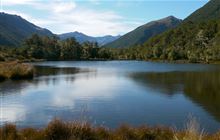
Home / Tracks / Lake Christabel tracks DOC Track · West Coast · Advanced Lake Christabel tracks Located in Victoria Forest Park A number of tracks lead to a hut at Lake Christabel. Location Open in Google Maps for driving directions → Map requires JavaScript. Open this location in Google Maps . Nearby on conservation land Lake Christabel Hut hut · 3.8 km · West Coast Top Robinson Hut hut · 4.2 km · West Coast Upper Nina Bivvy hut · 5.6 km · Canterbury Rough Creek Track track · 6.7 km · West Coast Devils Den Bivvy hut · 8.1 km · Canterbury Doubtless Hut hut · 8.3 km · Canterbury What you can do here Walking and tramping Official information Track conditions, closures, and detailed maps are managed by the New Zealand Department of Conservation. View Lake Christabel tracks on doc.govt.nz →